What was the Rainbow?

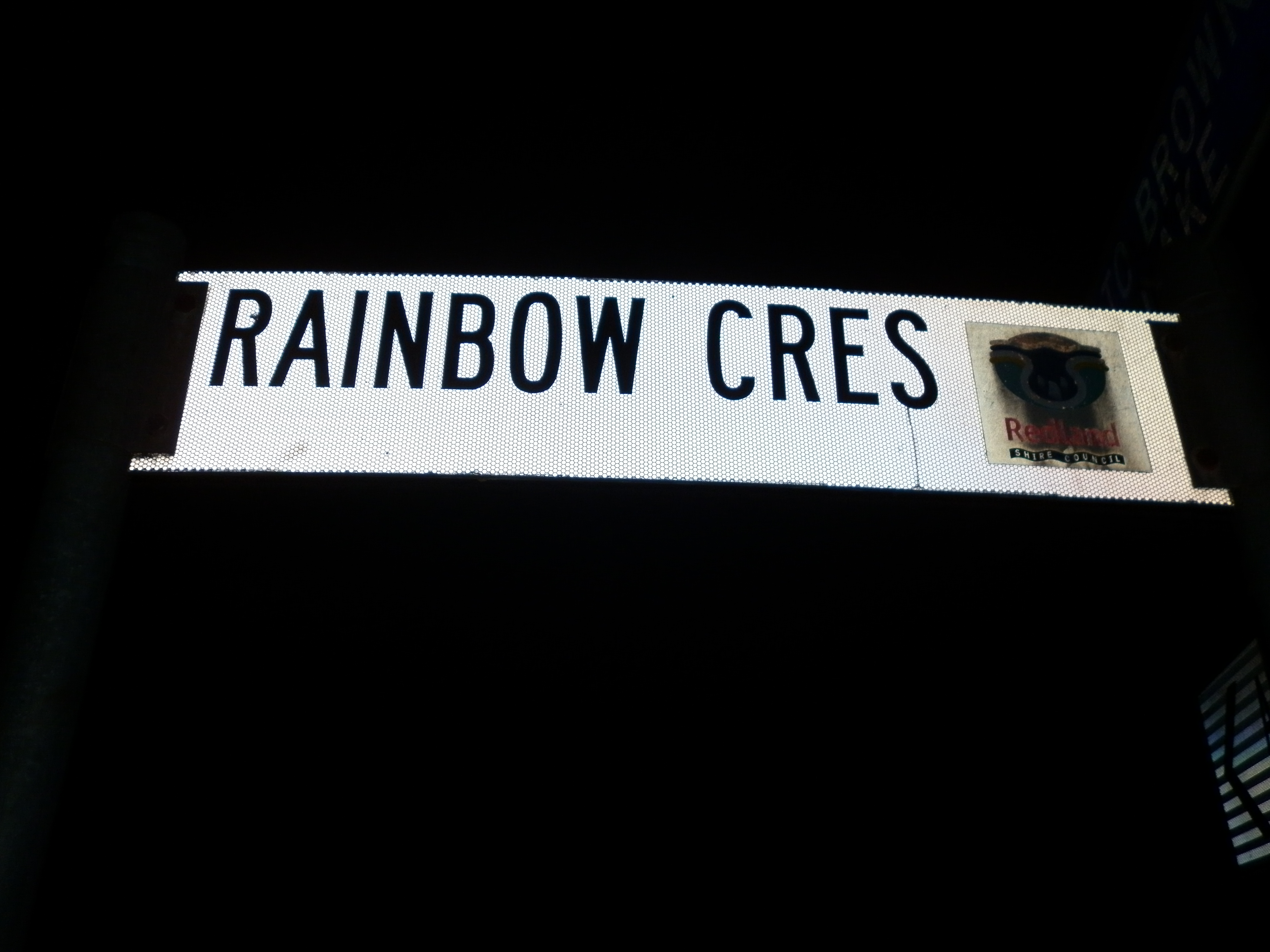
HMS Rainbow was a ship of war

photo 1(1)
The ship of war, Rainbow, deployed the word ‘Stradbroke’ in 1827.

“His Excellency, the Governor, has been pleased to direct that the island forming the Southern Boundary of the Eastern Channel into Moreton Bay shall be designated the Isle of STRADBROKE in complement to the Honourable Captain H.J. ROUS, commanding His Majesty’s ship RAINBOW, the first ship of war which entered Moreton Bay.” [Gov’t Order No.27, 16 July 1827]

P1030384
P1030324
Was Rainbow really the first ship of war? What about Amity which brought John Oxley and the invaders of the 28th Regiment 3 years earlier?
P1030333

Maps are the subject of this map.  RAINBOW did its survey work in 1827.  GUY’s 1948 survey of Dunwich appeared shortly after the Institution closed.

The Rainbow brought Governor Ralph Darling to Quandamooka for a quick visit.  Darling had replaced Thomas Brisbane as Governor of New South Wales.  Darling’s prior posting was military governor of Mauritius.  The imminent capture of Mauritius from the French had led to the release of Matthew Flinders, enabling Flinders to return to England to publish his charts of ‘Australia’.

Darling’s supposed ‘first ship of war’ to enter the east of Quandamooka was named after a symbol of peace, of pride, of science, of diversity, a symbol of creation.  The rainbow is many things to many people.  But was it the ‘first ship of war’ to enter the bay? What about Amity, which arrived with Oxley and the invading detachment of troops of the 40th Regiment, who landed in 1824?

This ship of war, named after a symbol of peace, engaged in survey work in Quandamooka.  My maps highlight that a survey in Australia has both military and civilian meaning.  The humble street map is a civilian tool.  It is also a war memorial.  The street map details key processes and stakeholders in the dispossession of the Traditional Owners as well as remembering other wars.

I have used a 1943 pamphlet from the War Office, called ‘Hints on Map Reading Instruction’ to shape the following framework to perceive the street map as a memorial.  It says

“The instructor should, before starting, get firmly into his mind what, for all practical purposes, the soldier requires to know”:-

 WORLD WAR 2 TRAINING NOTESEXHIBITION GUIDE


A map is…


A map is a plan or birds eye view of a piece of country… (The soldier) must understand the signs and symbols used to convey information on the map.

Readers of Australian maps are looking at a snapshot.  This snapshot spans a handful of generations of human life in a land that has been inhabited for thousands of generations.


Map references

(The soldier) must be able to indicate positions on the map to others by means of map references, and to find positions on the map indicated to him by map references.


Street and place names are the references on Australian maps, used in day-to-day conversation.  They are our vocabulary.


Time

(The soldier) must be able, by a glance at the map, to estimate the distance (approximately) on the ground between two points…  He must accustom himself to estimate how long it will take to reach any given point on a route, moving at a given speed.


A quick glance at a map can locate a piece of land within a particular timeframe, based on the street names.


Relationships

(The soldier) must be able to pick out from the map the high and the low ground, recognize the commonest ground formations, and be able to solve simple questions of the visibility of points from each other.Readers of Australian maps can identify meaningful relationships between place names.   (It’s unlikely that there will be many degrees of separation.)


Direction

in case he should ever be without a map, (The soldier) must have an elementary knowledge of the (apparent) daily movement of the sun so that if he knows the time he can estimate the sun’s approximate direction, and from this work out the direction he wishes to take.  Similarly he should be able to pick out the pole star at night, and be able to work out from this the direction he wishes to take.The chronology of the map helps us to understand where we have come from, and some of the significant decisions that brought us to this point.  It challenges us to identify whether or not our decision-making has changed in the interim.


What is the Otter now?

Dr Frederick Turnbull recommended the closure of the Dunwich Institution in 1946.  The Government Steamer OTTER’s 62 years of supply work from Brisbane to Dunwich came to an end.  P1030298

Captain JUNNER was one of her long serving masters.  P1030303

He was replaced in 1932 by Captain JACK, who had been working on the Otter as deckhand and mate.  P1030368

Billy NORTH was another sort of supplier to the Dunwich Institution.  He had a contract to supply beef from Pt Lookout.

P1030515

There is a good chance that Billy NORTH traveled on the OTTER in the presence of both Captains JACK and JUNNER.


What is the Otter, now?

The Otter was back in the news in Reconciliation Week, 2016, roughly one hundred and fifty years after it was de-commissioned.  It appeared in relation to the transition from sand mining to land use guided by the Quandamooka people.  Renewed interest in the Otter is related to imagining a 21st century vessel speeding between Junner St, Dunwich, and Captain Junner’s old landing place at Queens Wharf on North Quay, in Brisbane.

One of Australia’s early sand mines is located on the Kurnell Peninsular, Botany Bay.  This is near the site of James Cook’s first landing place on the land of the Gweagal people of the Tharawal nation, on 29 April, 1770. A history of sand mining in Australia could be invoked by journey from Cook St in Amity to Junner St in Dunwich.

Other street names of Amity point to another commentary on sand mining.  Fernandez St and Gonzales St are memorials to Fernandez Gonzales, who is the Great-Great Grandfather of Oodgeroo Noonuccal – poet and outspoken opponent of sand mining on Minjerriba.  Her poem, ‘Minjerriba’, begins as follows

Minjerriba was a giant in the sun

His green back coated with Cyprus and gum.

These lines show words functioning as both geographical markers and evocative communication tools.

Minjerriba – Stradbroke

Governor Darling’s visit to Quandamooka, aboard the Rainbow in June 1827 resulted in the name ‘Stradbroke’ being applied to Minjerribah.

Green Dunwich

Captain Logan somehow missed Darling’s visit.  However, he subsequently wrote to Darling about his plans for ‘Green Point’.  Darling had ‘Green Point’ re-named as ‘Dunwich’.[1]

Cyprus – Amity

Governor Brisbane’s visit, aboard Amity in 1824, resulted in the naming of ‘Point Amity’.  It was previously called ‘Cyprus Point’, by the English-speakers.[2]

Gum

Charles Fraser commented on Gum Trees when he visited Quandamooka as Colonial Botanist in 1827.  He also recognised trees named after Joseph Banks (Banksia), Matthew Flinders (Flindersia Australis), John Oxley (Oxleya xanthoxyla), and a species of pine (araucaria) soon to be associated with his companion, Allan Cunningham. Araucaria Cunninghamii is more commonly known as ‘hoop pine’.[3]

Eyes brimming with water so cool, he stretched for miles in the sun

And Pacific on the east, Quandamooka on the west

Bathed this giant in the sun

Sand mining began shortly after the Otter’s last visit to Dunwich.  Sand from the east coast was shoveled by hand and trucked overland to Dunwich on the west, with the first shipment leaving the Island in 1950.[4]  Oodgeroo’s poem laments the injustice and indignity.

But Minjerriba’s back is now broken

Men came and tore out his guts

Stole his rich grains of sand

Stripped his cloak of Cyprus and gum

Drained water from his ageless eyes

And weakened this giant in the sun

The following account of Andrew Petrie’s first visits to Amity and Dunwich (in 1837), suggests that it is unlikely that the grief and outrage among the Quandamooka People would have been much different had their lament been recorded 140 years earlier.

At Dunwich, by now a declining outpost, he supervised the loading of timber for Sydney by convict workmen.  Much of the cedar had been cut from the banks of the Brisbane, Albert and Logan rivers by convict gangs under arduous conditions, and unceremoniously dumped on the island.  By 1842, when the penal colony was disbanded, most of the best cedar in the district had either been pit sawn and sent to Sydney or lay rotting on local river banks.[5]

Leanne Enoch is a Quandamooka woman.  She is Minister for Innovation, Science and the Digital Economy as well as Minister for Small Business.  Her Reconciliation Week announcement, associated with the passage of the Bill that would end sand mining by 2019, communicated something of her sense of loss associated with sand mining.

“Much of the mining lease… covers traditional places of great cultural significance, places that traditional owners, my family, representing thousands of generations, do not have access to, cannot teach children about, cannot pass on to the next generation.  That is why it is important to understand that it is time for a new economy for North Stradbroke Island (known as Minjerribah in the local language).”

The Minister’s use of both words, Stradbroke and Minjerribah, is a sign that things are changing.  I am interested in how street maps document change, resistance to change and some of the important conflicts along the way.  For further reflections on how the street maps document change, resistance and conflict see the map entitled James Watt.

[1] (Steele has identified a note in October 1824, from ‘Brisbane Town in Convict Days)

[2] ‘On account of this friendly intercourse with these natives, the place was christened Point Amity’  (article in the Australian)

[3] Steele, J.G., 1983, The Explorers of the Moreton Bay District 1770-1830, University of Queensland Press

[4] North Stradbroke Island Historical Museum, 1994, Historic North Stradbroke Island, NSIHM Inc. Dunwich p. 146

[5] From Dorman, D and Cryle, C, 1992, The Petrie Family: Building Colonial Brisbane, UQP, p.22


The wreck of the Sovereign

Sovereign 2

11 March, 1847: Mr Gore’s bag, as well as some of Mrs Chettle’s trinkets were washed up onto the beach, as were the bodies of Mr Gore’s wife and oldest child. The Sovereign had sunk in heavy seas between Moreton and Stradbroke Islands. Mr Berkeley was lost in the breakers. He had been clinging to the same piece of wreckage as the ship’s Captain, who was carried ashore unconscious by an Aboriginal man. Captain Cape survived. 44 people died when the Sovereign was wrecked. 10 people were saved by a group of Aboriginal men. One of those men is remembered as Toompany.

Toompany and his company have left us a wonderful memory of Sovereignty in our own age of ‘Sovereign Borders’. Their own borders had been violated, and the intentions of the new arrivals were not clear. The beliefs of the new arrivals were bewildering.  Toompany and company risked their own lives to save these foreigners, who asserted a foreign sovereign which took many forms.  Sometimes it took the form of a great woman in a distant land, who controlled great armies, sometimes a coin, sometimes a man who would defeat death, and now, a ship devoured by the waves. The actions of Toompany and his sovereign company are vital memories for all Australians in one of the sacred struggles of our age.

Even some recent accounts of the wreck of the Sovereign tell the story without reference to the role of the Traditional Custodians in saving the lives of 10 passengers.

When I read the accounts of the last moments of the lives of the Gore family and Mr Berkeley, I was profoundly touched. Along with some of these details about the wreck of the Sovereign (below), I have include an old hymn. It is a fitting sound track and tribute to the last moments of the lives of the Gore family.

I want to remind the people who want to assert and nurture Australia’s Christian heritage that this heritage includes an appreciation that human life at sea can be perilous, which did not stop them from traveling by boat. This same Christian heritage abounds in expressions of compassion for travelers on the ocean and with prayers for their arrival in safe harbours.


The following details about the characters listed in the street names of North Stradbroke Island are copied from Thomas Welsby’s book , Early Moreton Bay, published by Rigby in 1913. (pp 61-63)

From ‘The loss of the ‘Sovereign’ Steamer, wrecked 11th March 1847’ As printed by the ‘Moreton Bay Courier’ in an extraordinary, issued 17th March 1847.

Mr and Mrs Gore

‘Mr Gore, addressing his wife, said ‘Mary, there is no hope for us now; we shall go to heaven together.’ Mrs Gore, turning to the stewardess said, ‘We can die but once. Jesus died for us. God keep us.’ She repeated these short sentences several times, and seemed perfectly prepared to meet the inevitable fate which awaited her with calmness and Christian-like resignation.’

Mr Stubbs

“As Mr Stubbs was swimming, he saw for the last time, Mr Gore cling to the skylight with the child in his arms. Shortly afterwards a man with a blue shirt and dark hair came close to him, supported by a long piece of wood, which hit him in the head and nearly rendered him senseless. Having escaped this danger he had to encounter another still more formidable. He saw breakers ahead proceeding from the bar, which appeared coming towards him like a wall, upwards to fifteen feet in height, frothing and foaming, and enough to appall the stoutest heart. How he got through them he does not recollect, for he saw nothing more until he reached the shoal water of the beach, which was about four miles from the spot where he left the vessel. He had just vigor enough remaining to get out of the reach of the breakers, when a native belonging to the pilot’s crew seized him by the waist, and supported him till his strength returned.”

Captain Cape

“(Captain Cape) managed to catch hold of the paddle-box and called to Mr Berkeley to come to him which he did; and they kept company for an hour and a half. On nearing the surf Captain Cape advised him to hold on with all his strength in going through the heavy breakers, when Mr Berkeley immediately called his attention to the mountain wave behind. The water broke upon them, and poor Berkeley disappeared. Captain Cape sustained three more breakers, and does not remember anything else until he found himself on a hillock of sand on the beach, where he had been carried by the black who dragged him through the surf. As soon as he had partially recovered his strength the natives conducted him to the part of the beach where Mr Stubbs was. On going there, they found the body of Mrs Gore, which had been washed up near the spot where Mr Stubbs landed, and shortly afterwards they found the body of her eldest child.”

“Mr Richards and Mr Clements who were fishing in that neighbourhood, rendered every assistance in their power, and aided by a prisoner of the Crown, named William Rollings, a servant of the pilot, and the native crew, by the most who, but for their assistance, must have perished in the surf.”

“The only articles washed up before the party left the island, at sundown, were some trinkets belonging to Mrs Chettle and a small, but heavy case with Mr Gore’s name upon it.”